Type
Academic | KU Leuven
Objective
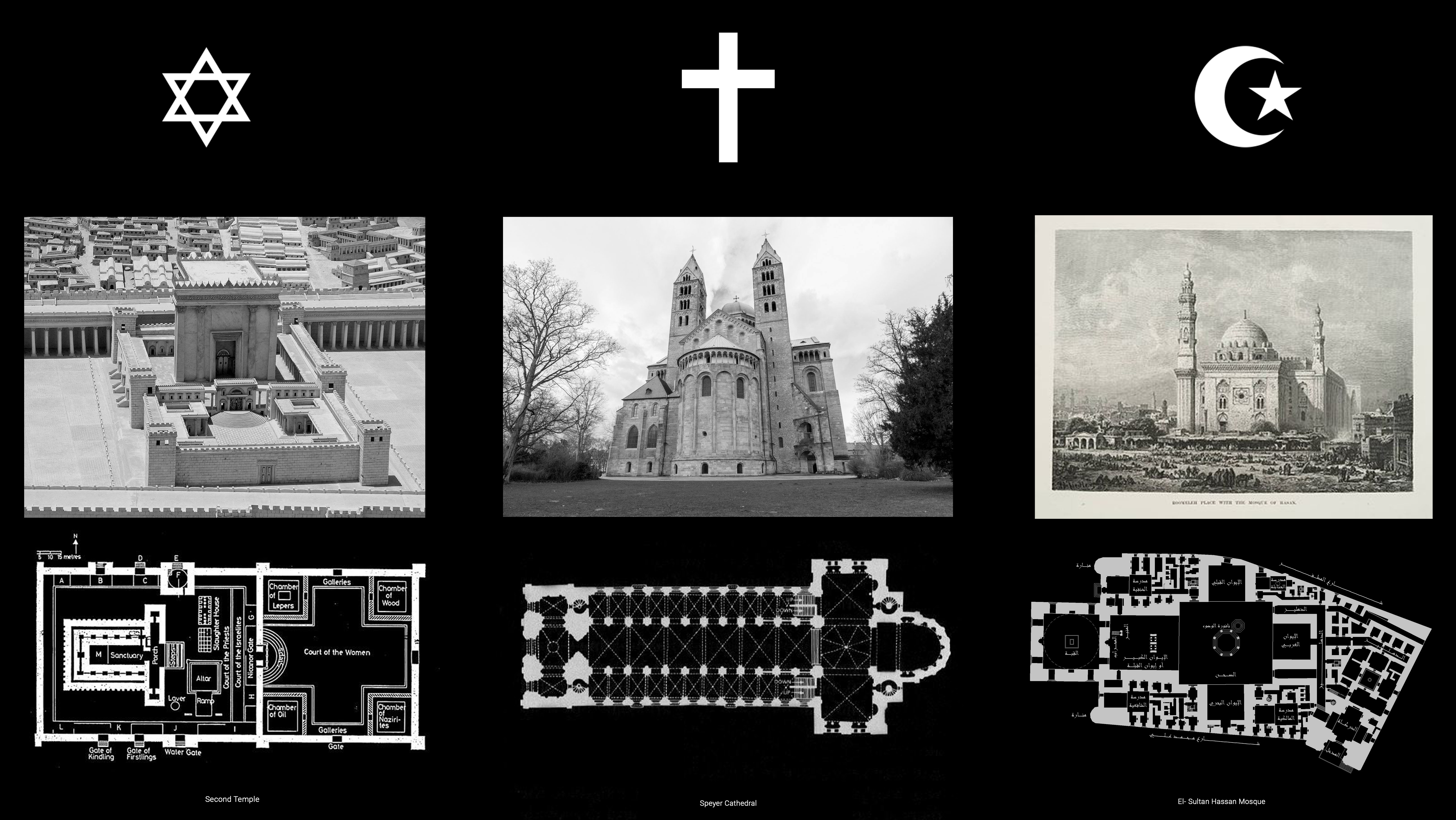
Explore using space syntax to merge three religious building typologies together: a synagogue, a church, and a mosque
Role
Computational Design
Result
Recognized for strong academic concept and execution
Situation
This project explores the concept of spatial configuration through the lens of space syntax and graph theory, aiming to deepen the understanding of how space is structured and experienced. The research builds on methods typically applied in architecture and urban studies, with the broader ambition of extending them to fields where configuration and pattern play a central role.
Project
I developed an interactive zoning diagram using Rhinoceros and Grasshopper, applying graph-based logic to architectural design. The investigation focused on merging three religious buildings into a unified spatial concept. Each zone in the resulting diagram represents both its physical area and its spatial integration, offering a layered perspective on connectivity, flow, and sacred spatial relationships.
Process
The first step in this investigation was to abstract each building into a simplified graph, mapping zones based on their function and accessibility. Starting from the bubble diagrams, spatial zones were visualized as nodes, with connections representing paths or visibility. Red nodes indicate highly integrated areas—zones connected to many others—while blue nodes represent more private, secluded spaces.

Analysis revealed unique patterns in each building typology: in Islamic and Jewish architecture, the inner courts are the most integrated zones. In contrast, in churches, the crossing area holds the highest integration, while the holiest room in the Jewish temple is the most private, resembling the Founder’s tomb in the mosque and the apse in the church.
To explore merging strategies, this proposal focused on depth levels within each building's spatial hierarchy. Zones at similar depths were linked across the three graphs (creating new interfaith connections) while maintaining their original internal links (old links). Entrances were intentionally positioned side by side to encourage user convergence and interaction.

The resulting bubble diagram reflects a sophisticated integration of spatial systems. Interestingly, the Islamic inner court and West Iwan emerged as the most integrated zones—possibly a result of the mosque’s complex spatial layout. However, some unexpected connections appeared, such as classrooms linked to the holiest space, prompting further reflection on functional coherence in spatial merging.
